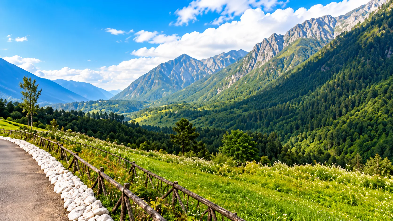
Some destinations are worth visiting for what is in them. Kibithoo is worth considering for where it is. At the far end of the Lohit Valley in Eastern Arunachal Pradesh, it sits among high ridges and fast rivers, close to the country's international border. The road that brings you here passes forest, gorge and small settlements, and it gets quieter the further you go.
This is not a conventional sightseeing stop with a list of attractions. It is a place for travellers who enjoy long mountain roads, remote scenery and the feeling of reaching the edge of a map, and who are prepared for uncertainty. This guide explains where Kibithoo is, what you can reasonably experience there, how to approach the trip and how to travel responsibly in a sensitive frontier area.
Where Is Kibithoo?
Kibithoo, also written Kibithu, is a frontier settlement in Anjaw district, in the far east of Arunachal Pradesh. It lies in the upper reaches of the Lohit River valley, beyond Walong, in a landscape of steep forested ridges and narrow river valleys. It is close to the international border, which shapes much of what happens there.
The district headquarters is Hawai, and the road to Kibithoo follows the Lohit upstream through Anjaw. The valley rises as you go, and the climate and vegetation change with it. Behind the settlement, high mountains close the horizon.
In the wider geography of the state, Kibithoo is at the end of one of several separate river valleys. The Siang, Dibang and Lohit valleys each have their own roads, and they are not linked directly across the mountains in the way a map might suggest. Reaching Kibithoo means committing to the Lohit valley.

Why Visit Kibithoo?
A remote Himalayan setting. The scenery is large and uncrowded, with forested slopes below and high ridges above. On clear days the views are wide, and in cloud the valleys take on a quiet, closed-in feel.
Frontier character. Kibithoo's position near the border gives it a different atmosphere from most tourist destinations. The area has a visible military presence, and its history is tied to the frontier. Visitors should treat this seriously.
Landscapes. The Lohit and its tributaries shape the land, and rivers, gorges and bridges are a constant feature of the journey.
Cultural interest. Anjaw district is home to several communities, including groups associated with the Mishmi Hills and nearby valleys. A traveller who listens and asks respectfully can learn about local life.
The road-trip experience. For many people, the journey is the destination. Winding roads, long drives through forest and unexpected views are why people come.
Photography. Light, mist and mountain scenery offer much for photographers, with the important caveat on sensitive locations covered below.
If you want a lot of organised activities, restaurants or comfortable lodging, Kibithoo is probably not the right place. If you want a slow, remote journey, it might be.
Things to See and Experience in and Around Kibithoo
Kibithoo has few formal tourist sights, and I would rather say so than invent them. These are experiences the region reasonably supports.
The Lohit Valley road journey. The drive up the valley is a main experience in itself. It passes forest, river gorges and villages, and it gives a sense of how remote the area is. Stop at safe viewpoints and take your time.
Kibithoo and its surroundings. The settlement and its surrounding ridges offer quiet scenery and a sense of the frontier. Your guide or host can tell you which areas are open to visitors and which are not.
Walong. On the way, Walong is known for its place in the history of the 1962 conflict and has memorials associated with it. If you visit, treat the memorials as places of remembrance.
Dong Valley. Dong, further along the Lohit, is often described as the place where India sees its first sunrise. It is usually visited as a separate leg or day trip. See our Dong Valley Travel Guide.
Village life and local culture. If you meet people along the way, a polite greeting and a few questions can lead to conversations. Do not enter homes without invitation, and ask before photographing anyone.
Parshuram Kund and Tezu. Many travellers pass through Lohit district on the way. Our Parshuram Kund Travel Guide and Wakro Travel Guide cover places along the valley.
Kibithoo and Eastern Arunachal Pradesh
Kibithoo works best as the far end of a Lohit valley journey, combined with other places along the way. A typical route runs from Assam up through Tezu, Parshuram Kund and Walong to Kibithoo, with Dong as a possible extension. It does not combine easily with the Siang or Dibang valleys, which are reached by different roads from Assam.
If you are choosing between remote destinations, it helps to know the character of each. Kibithoo and Dong are frontier destinations in the Lohit valley. Anini, in the Dibang valley, is a high mountain headquarters and the heartland of the Idu Mishmi community.
How to Reach Kibithoo
Plan to confirm each stage before you travel.
Most visitors approach from upper Assam. Dibrugarh and Tinsukia are widely used gateways, and Tezu in Lohit district has an airport. From there, you continue by road through Lohit district and up the valley, often passing Parshuram Kund and Walong before reaching Kibithoo.
Hired vehicles are the usual way to travel. Shared transport may operate on parts of the route, but I cannot confirm what is running. A driver who knows the road is strongly recommended.
Roads in the Mishmi Hills are affected by rain, landslides and maintenance, and the upper valley can be slow and difficult. Leave generous buffer time, and expect that a plan may change at short notice. Ask locally about current conditions before you set out each day.
Do not plan to see Kibithoo on a tight schedule. Landslides, weather and permissions can easily delay a day.
Permits and Travel Requirements
Arunachal Pradesh regulates entry. Indian citizens who are not residents of the state generally need an Inner Line Permit, and foreign nationals have separate requirements. For frontier destinations such as Kibithoo, additional permissions or restrictions may apply, and access can change quickly depending on local conditions and security arrangements. I have not stated any specific rules, because I cannot verify them.
Before you commit to a trip, confirm the rules for Kibithoo specifically with official sources or a reputable local operator, and confirm again close to your departure date. Carry printed copies of your permits and photo ID, since checkpoints are common. Our Arunachal Pradesh ILP Guide gives general background, but treat it as an overview and not a substitute for current official rules.
If you cannot confirm access, have an alternative plan. Many travellers choose to make Walong or other Lohit valley destinations the main focus, with Kibithoo as a possible extension.
Best Time to Visit Kibithoo
Cooler, drier months. The months after the monsoon through the winter are generally the best time for travel. Roads are more reliable, skies are clearer and views are better. Nights can be cold, and high areas can see snow, which may affect access.
Spring. Weather warms and showers become more likely. It can be a good time for green slopes and flowers, though conditions vary and cloud may hide the views.
Monsoon. Heavy rain is common, rivers rise and landslides are more likely. Roads can close for days. Some travellers enjoy the green scenery, but this is the hardest season for a trip to Kibithoo, and delays should be expected.
Comfort and access trade off against each other. The easiest months for travel tend to be the coldest, and the greenest months tend to be the hardest. Decide which matters more to you.

How Many Days Do You Need?
Distances are large and roads are slow, so Kibithoo needs more days than a map suggests.
Short trip. A rushed visit is not recommended. If time is limited, consider a shorter Lohit valley trip around Tezu, Parshuram Kund and Wakro instead.
Reasonable plan (about 4 to 5 days from Tezu). This allows a day to travel up the valley, time at Walong, a day for Kibithoo and a day or two of buffer for weather or permissions.
Longer plan (6 to 8 days or more). This allows a relaxed pace, an extension to Dong and time to explore villages and viewpoints. Starting from Dibrugarh or Tinsukia adds days at either end.
Always keep at least one spare day. If the road or the permits cause delays, a spare day saves the trip.
Suggested Kibithoo Itinerary
Day 1. Arrive in Tezu, confirm permits and vehicles, and rest. Visit Parshuram Kund if time allows.
Day 2. Travel up the Lohit Valley toward Walong. Stop at viewpoints and villages, and arrive with daylight to spare.
Day 3. Visit Walong and its memorials, then continue toward Kibithoo, subject to permissions and conditions. Spend time at the frontier, and return to your night stop.
Day 4. Use this as a flexible day. It could be an extension to Dong, time for photography and village walks, or a buffer if weather or permissions have delayed you.
Day 5. Begin the return journey toward Tezu.
Flexibility matters most on Days 2 to 4. Landslides can block the road, permissions can change and weather can close views. Treat each day's plan as provisional until you are on the road.
What to Pack for Kibithoo
Warm layers. Nights are cold at altitude, and a warm jacket, hat and gloves are useful in much of the year.
Waterproof clothing. A good rain jacket, pack cover and spare dry clothes are important in any season.
Comfortable shoes. Grippy boots or shoes that can handle wet, uneven ground.
Medicines. Your regular medication, a first-aid kit and motion-sickness tablets for winding roads. Medical help can be far away.
Power bank. Electricity can be unreliable. Carry a power bank and spare batteries.
Cash. ATMs are scarce in remote areas, and digital payments may not work. Carry enough cash for the trip.
Documents. Permit copies, photo ID and booking confirmations in a waterproof bag.
Sun protection. Sunscreen, sunglasses and a hat, since sun at altitude can be strong even in cold weather.
Connectivity, Food and Accommodation
Connectivity. Mobile coverage in the upper Lohit valley can be patchy or absent, and it varies by network. Do not rely on being reachable. Download maps and keep key numbers offline, and tell someone your plans.
Food. Expect simple meals, usually based on rice, dal and local vegetables, with limited choice. Carry snacks and water, particularly on long road days, and let your host know about dietary needs in advance.
Accommodation. Options at the far end of the valley are generally basic, and may include simple lodges, guesthouses or homestays, with limited availability. Book ahead through a reputable operator, and confirm what is included, such as meals, hot water and power backup. Larger towns such as Tezu offer more choice, and many travellers use them as a base.
Responsible Travel in Kibithoo
Respect local communities. People here live in a remote and sensitive area. Greet politely, ask before entering any home or sacred place and follow local advice.
Photography etiquette. Ask before photographing people and ceremonies, and accept a refusal.
Respect sensitive locations. Border and security areas can have restrictions on photography, movement and access. Follow all signs and instructions from officials and security personnel, do not photograph military installations or personnel, and do not stray off permitted roads. Avoid flying drones.
Environmental responsibility. Mountain ecosystems are fragile. Stay on paths, keep noise low, leave plants and animals alone and keep chemicals out of rivers.
Avoid litter. Waste collection is limited in remote places. Carry your rubbish out, use refillable bottles and avoid single-use plastic.
Think before you post. Avoid sharing exact locations of sensitive places in real time, and consider whether an image might cause problems for local people.
FAQs
Where is Kibithoo?
Kibithoo, also written Kibithu, is a frontier settlement in Anjaw district, in the far east of Arunachal Pradesh, in the upper Lohit Valley near the international border.
Is Kibithoo worth visiting?
For travellers who enjoy remote mountain roads and frontier landscapes, yes. It is not suited to people wanting formal attractions or comfortable facilities.
How do I reach Kibithoo?
Most travellers go by road from upper Assam through Tezu and up the Lohit Valley. Verify current routes, transport and road conditions.
Do I need a permit for Kibithoo?
Non-resident Indian citizens generally need an Inner Line Permit, and frontier areas may have additional rules. Verify current requirements with official sources.
What is the best time to visit Kibithoo?
The cooler, drier months after the monsoon are generally best. The monsoon brings heavy rain and landslides.
How many days do I need for Kibithoo?
About four to five days from Tezu is a reasonable minimum, with buffer days for weather and permissions.
Is there mobile connectivity in Kibithoo?
Coverage can be patchy or absent. Download maps in advance and do not rely on being reachable.
Can I take photographs in Kibithoo?
Yes in many places, but ask before photographing people, and do not photograph military installations or other restricted areas. Follow local instructions.