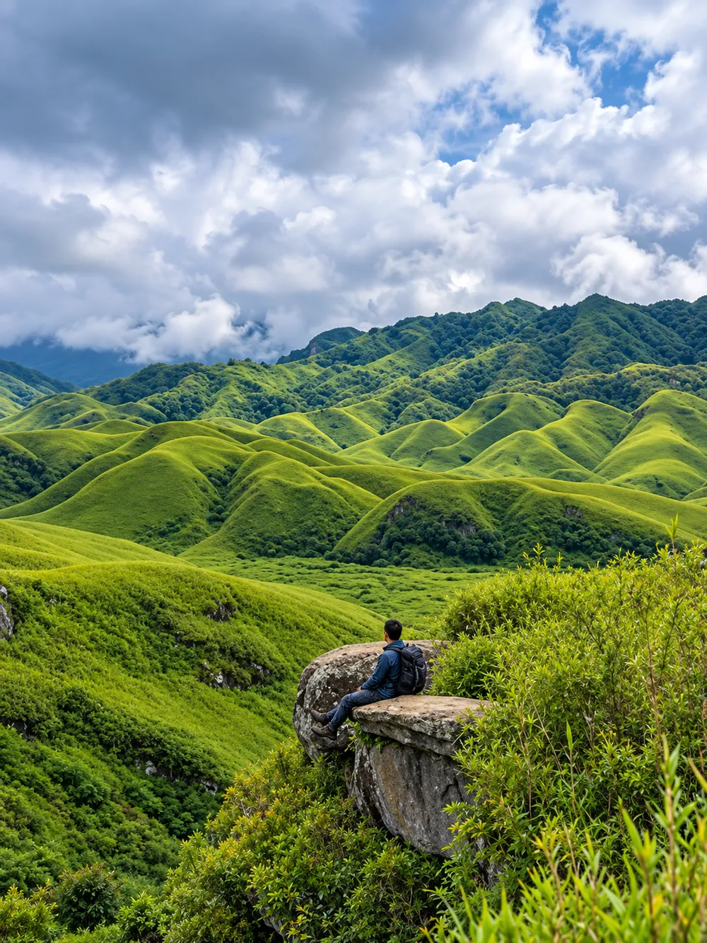
Dzükou Valley sits at about 2,452 metres on the border of Nagaland and Manipur. It is a high fold of grassland and forested ridge, often called the Valley of Flowers of the Northeast, and no road reaches it. Everyone arrives on foot. You climb a ridge, cross the top, and the valley opens below you in long green slopes with a cold stream running through the middle. The name comes from the Angami and Mao word for "cold water", which refers to that stream.
For trekkers in Northeast India, Dzükou is a rare combination: a trail that beginners can manage with some preparation, and a landscape that looks like nowhere else in the region. This guide covers the routes, the weather, the practical details of getting there, and what to know before you camp or stay overnight. Some details, such as permits, trail status and prices, change from season to season, so we point out where you should check before you go.
Where is Dzükou Valley?
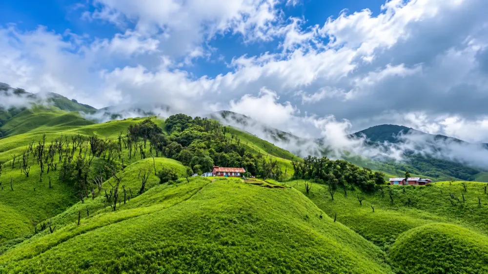
The valley lies in the Kohima district of southern Nagaland and runs up to the Manipur border, behind Japfü Peak. Its high grassy floor is separated from the villages below by steep forested slopes, which is why the walk in is the only way to see it.
Nagaland has two usual ways in. One starts at Viswema village and the other at Jakhama, which appears as Zakhama on Google Maps. Both villages lie along the highway that runs south from Kohima toward Manipur. Sources give slightly different distances, but Jakhama is roughly 20 km from Kohima and Viswema is roughly 22 to 25 km, so either is around an hour's drive on a normal day.
That makes Kohima the natural base. It is Nagaland's capital, it has the widest choice of hotels and homestays in the area, and it is where most trekkers arrange shared taxis to the trailheads. The nearest airport and railway station are both at Dimapur, roughly 70 km from Kohima. Guwahati is the closest major airport with wide connections. If you are building a longer trip around Nagaland.
Why visit Dzükou Valley?
The main draw is the landscape. Grass-covered hills roll down to a valley floor, and the light changes fast when cloud moves through. In some seasons the slopes are bright green, in others they turn golden brown, and the valley looks like a different place on each visit.
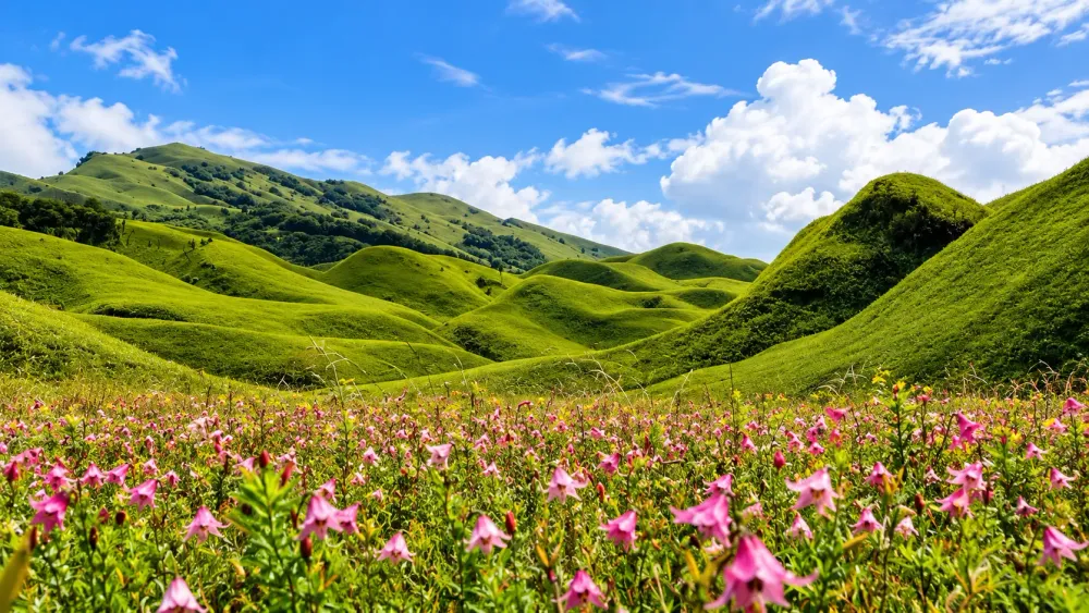
Flowers are the second draw. The Dzükou lily is the best known, and it typically blooms in late June and July, though the exact window shifts with the rains.
Trekking is the reason most people come. The walk is long enough to feel like an achievement and short enough that many people do it over a weekend. Camping or a night at the basic guest house lets you see the valley at sunrise and sunset, when the hills are quiet and most day visitors have gone.
Dzükou Valley trek
There are two main routes, and the choice between them shapes your day.
The Viswema route is the popular one and the usual choice for first-timers. A rough motorable road climbs part of the way from the village, and depending on your transport and the road's condition you can drive some of it or walk it. From the end of the road you take a steep stretch of stone steps up to a ridge, which most trekkers describe as the hardest hour or two of the whole trek. After that the trail flattens and then descends toward the valley, with a further walk across open grassland to the guest house and campsite. Most sources put the total time at around 4 to 6 hours one way, and roughly 7 to 10 km of walking, but the number depends on how far the road carries you, the weather and your own pace.
The Jakhama route is shorter but steeper. The climb starts soon after the village and keeps going through forest, with stone steps in places. Some trekkers like it for that reason, and it tends to be quieter. Many prefer to use it for the descent, because the steps are easier to walk down than to climb. A common plan is to go up via Viswema and come down via Jakhama, provided you can arrange transport between the two villages afterwards.
The terrain is a mix of forest trail, stone steps, muddy patches and open grass on the valley floor. Expect the trail to be slippery after rain. Conditions change with the season, and the trail was closed for a period in early 2026 after a wildfire before local authorities reopened it. Local groups have also issued trekking guidelines in recent months. Check current trail status and rules with your accommodation or a local operator before you set out.
Indian citizens who do not live in Nagaland need an Inner Line Permit, which can be applied for online or through Nagaland House offices. Foreign visitors are generally asked to register with the local police. Rules change, so confirm both before you travel.
Best time to visit Dzükou Valley
The valley is open to trekkers for much of the year, but the experience varies a lot by season.
Spring, roughly March to April, is cool and fresh, with fewer crowds and generally clearer views than the monsoon. The grass is still recovering from winter, so the valley is less lush than it will be later.
Summer brings the flowers, and the monsoon rides along with it. The trail turns muddy, visibility can drop to a few metres, and landslides are a risk on approach roads. Late June and July is when the Dzükou lily usually blooms, and the hills are at their greenest. This is also the busiest and wettest period, so plan for rain, low cloud and leeches on forest sections.
Autumn, from late September through November, is what many trekkers consider the best window for weather. The air is dry, skies are usually clearer, and the grass begins to turn gold. You get good views with a more comfortable trail, though you miss the lilies.
Winter, from December to February, is cold and dry. Nights can fall below freezing, the grass turns brown, and the valley looks bare but dramatic. Dry grass also burns, which is why the fire earlier this year mattered. If you go in winter, carry proper cold-weather gear and check the trail is open.
How to reach Dzükou Valley
Almost every route goes through Kohima.
By air, the nearest airport is Dimapur. Guwahati is the other common entry point, with more flights from major Indian cities. From Guwahati you can continue by train or road to Dimapur.
From Dimapur, the road to Kohima is roughly 70 km. Shared taxis, sumos, buses and private cars run the route, and it usually takes a few hours depending on traffic and road conditions. Shared taxis often leave only when full, so allow time.
From Kohima, you need to reach either Viswema or Jakhama. Shared taxis run from the main stand, and you can also hire a taxi privately. The drive is around an hour. Prices and schedules change, so ask your hotel or a local operator for the current arrangements rather than relying on old figures.
If your trip happens to fall in early December, the Hornbill Festival at Kisama is close to Kohima, and our explains how to plan around it. For a wider regional plan, see the
Dzükou Valley trek difficulty
The trek is usually described as easy to moderate on the Viswema side and moderate on the Jakhama side. That is a fair summary, but it hides the fact that the walk is long and the altitude gain is real. The trailheads sit at roughly 1,600 metres and the valley at around 2,450 metres, so you gain somewhere near 800 metres over the day.
The steepest part is the climb to the ridge. It is short compared with a typical Himalayan ascent, but it is sustained, and on a wet day the steps and mud slow everyone down. After that, the walking is easier, although the total distance and time can tire people who are not used to long days on foot.
Weather is the biggest variable. Rain makes the trail slick and adds time, cold wind makes the ridge unpleasant, and low cloud hides the views you came for. Altitude at this height rarely causes serious problems for healthy people, but some may notice a mild headache or extra tiredness. Drink water, go at your own pace and descend if you feel unwell.
What to pack for Dzükou Valley
Pack for cold, wet and long. Even in summer, nights in the valley are cold.
Footwear matters most. Wear trekking shoes with good grip, since the trail can be muddy and the stone steps are slick when wet. Carry a rain jacket or poncho and a waterproof cover for your pack. Bring warm layers: a fleece or down jacket, a thermal base layer, a hat and gloves for the evenings. Carry at least a couple of litres of water, with a way to refill or purify it, and bring snacks that give quick energy, such as nuts, biscuits and chocolate.
Include a basic first-aid kit with plasters, pain relief, oral rehydration salts and anything you take regularly. Because there is generally no mobile network in the valley, download offline maps and tell someone your plan. A power bank helps, since electricity at the guest house is limited. Carry a torch or headlamp, and if you visit in the monsoon, bring salt or a leech repellent for the forest sections.
If you plan to camp or stay in a dormitory, check in advance what bedding and tents are available. If you are unsure, carry your own sleeping bag rated for cold nights. Food supplies in the valley are limited and can run out, so bring what you need.
Camping in Dzükou Valley
Dzükou Valley camping is possible, but the options are basic and the rules are worth checking. In the valley there is a simple guest house with dormitory-style bunks and a designated campsite beside it. Camping outside designated areas, including along the stream, has been restricted in the past because of littering, so use the official spots.
Do not expect hotel comforts. Electricity is limited, there is generally no mobile network, and some simple food may be available but supplies can run short. Nights are cold at any time of year, so a proper sleeping bag matters. Arrange your bunk or tent before you set out where you can, and ask your operator or the local community about current rules and fees. We do not quote fees here because they change. An overnight stay lets you see the valley in evening and morning light without rushing the trek.
Dzükou Valley itinerary
These are outline plans. Adjust them to the season, the trail status and your fitness.
One-day option
A day trip is possible for fit trekkers who start very early from Viswema, but it is tight. You will spend most of the day walking, with little time in the valley itself, and you need to be back on the trail early enough to finish before dark.
Two-day trek
Day 1: Leave Kohima early and drive to Viswema. Walk or ride to the end of the motorable road, then climb the stone steps to the ridge and continue into the valley. Reach the guest house or campsite in the afternoon, settle in and walk around the nearby hills before sunset.
Day 2: Wake early for sunrise and explore more of the valley. After breakfast, descend. You can return via Viswema, or take the steeper Jakhama trail down if you have arranged transport. Reach Kohima by the evening.
Three-day option with Kohima
Day 1: Arrive in Kohima. Spend the afternoon exploring the city and getting your permits and transport in order. Kohima's war cemetery and local markets are good places to start.
Day 2: Drive to the trailhead and trek into the valley as above. Stay at the guest house or campsite.
Day 3: Spend the morning in the valley, then descend and return to Kohima. If time allows, visit Kisama or another local site before leaving. For other routes to build into a longer trip, see
Responsible trekking
Dzükou is a fragile place, and it is also a place that local communities look after. Following a few rules keeps it that way.
Do not litter, and carry your waste back down with you. The valley has been treated as a plastic-free zone since 2019, so bring as little plastic as possible and pack out everything you bring in. Do not pick flowers or damage plants, and stay on marked trails, since off-trail walking wears down the grass and damages the roots of rare species.
Respect the villages you pass through. Ask before photographing people, dress modestly in villages and buy from local shops and homestays where you can. Do not disturb wildlife, keep noise low, and avoid feeding animals. Follow any rules set by the forest department or local community bodies, including camping restrictions and fire rules. In dry months, never light open fires or leave cigarettes behind.
Frequently asked questions
How long is the Dzükou Valley trek? Most sources put the walk at roughly 4 to 6 hours one way, depending on the route, how far a vehicle takes you and your pace. Plan for a full day of walking.
Is the Dzükou Valley trek difficult? It is generally considered easy to moderate from Viswema and moderate from Jakhama. The steep climb to the ridge is the hardest part, and weather can make it tougher.
Can beginners do the Dzükou Valley trek? Yes, with some preparation. Walk regularly beforehand, choose the Viswema route, pick a stable season and consider a local guide.
What is the best time to visit Dzükou Valley? For flowers, late June to July. For clear views and easier walking, late September to November. Spring is good too, while winter is cold and the monsoon is muddy.
Where is Dzükou Valley located? It is in the Kohima district of Nagaland, along the border with Manipur, about 20 to 25 km from Kohima by road to the trailheads.
How do I reach Dzükou Valley from Kohima? Take a shared or private taxi to Viswema or Jakhama, roughly an hour away, then trek in. Confirm current transport options locally.
Do I need a permit to visit Dzükou Valley? Indian citizens who do not live in Nagaland need an Inner Line Permit. Foreign visitors are generally asked to register with the police. Check current requirements before you travel.
Can you camp in Dzükou Valley? Yes, in the designated campsite near the guest house. Camping elsewhere has been restricted, so confirm the current rules.
Is there mobile network in Dzükou Valley? Generally no. Download maps offline and share your plan with someone before you start.
How cold does Dzükou Valley get? Nights are cold in every season, and in winter temperatures can fall below freezing. Bring warm layers even in summer.
Is Dzükou Valley open all year? Trekkers visit in most seasons, but the trail can close for weather, landslides or safety reasons. It was closed for a period in early 2026 after a wildfire. Always check current status.