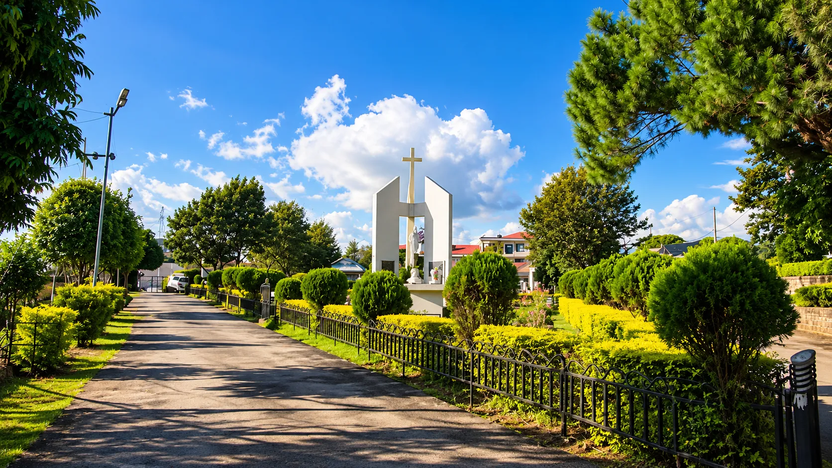
Lunglei is where many travellers realise how big Mizoram is. The road south from Aizawl runs for hours through ridges, valleys and small towns, and the reward is a hill town that feels quieter and more regional than the capital. It is the second largest town in the state and the main base for the south, which makes it a sensible stop for anyone who wants to see beyond the usual northern circuit.
This Lunglei travel guide explains where the town is, what makes it worth the journey, which places are documented as worth visiting, how the landscape looks and feels, local culture, how to reach it, how long to stay and how to plan a route. It gives no prices, schedules, distances or permit rules, because they change or vary between sources, and it tells you what to confirm before you travel.
Where Is Lunglei?
Lunglei is a hill town and district headquarters in southern Mizoram, set among ridges and river valleys. It is the second largest town in the state after Aizawl, and it serves as the commercial and administrative centre for much of the south. For a wider view of the state and how its towns connect, see our Mizoram travel guide.
The name is usually explained as meaning a bridge of rock. According to the district's tourism material, the town takes its name from a rock formation resembling a bridge, found in a stream near Nghasih, a small tributary of the Tlawng river. It is a useful detail to know before you arrive, because the stone bridge is one of the places listed for visitors.
Most travellers reach Lunglei from Aizawl by road, a long journey on winding hill roads. We have not quoted distances or journey times, because published figures differ and road conditions change.
Why Visit Lunglei?
The setting is the first reason. Lunglei is spread across a hill, with houses and streets stepping along the slopes and views opening across layered ridges. It has a hill-town character that differs from both Aizawl and the open valley country of the east.
It is also a good place to see the south. The surrounding district has forest, rivers, villages and a handful of documented heritage and nature sites, and the town works as the base for reaching them.
Cultural character matters too. Lunglei is part of the Mizo world, with church life, community gatherings and everyday markets shaping the week. The district's tourism material also points to places linked with the arrival of missionaries and with a Buddhist relic, which adds layers to the usual picture of the state.
Finally, the route is part of the experience. The drive from Aizawl passes through towns including Serchhip and Thenzawl, and it suits travellers who are happy to let the road be part of the trip. If you want polished facilities and a long list of attractions, Lunglei will feel modest.
Best Places to Visit in Lunglei
This list uses places named in the Lunglei district's official tourism material and in published travel references. Confirm access, conditions and any arrangements locally before you go.
Lunglei's stone bridge and the Nghasih stream are tied to the town's name. The rock formation that gave the town its name is described as lying in a stream around Nghasih, and it is the most direct way to connect the town to its origin. Ask locally about access and conditions.
Lung Milem, listed by the district as a religious site, is an engraved image of the Buddha on a rock near Mualcheng village, south of Lunglei. The district describes it as the only Buddhist relic found in the state and notes that its origin remains unexplained. Treat it as a heritage and curiosity site, ask locally about the road and approach, and respect it as a place of religious meaning.
Khawnglung Wildlife Sanctuary is a mountain and protected area listed by the district, reached on the Aizawl to Lunglei road near Pangzawl. It suits travellers interested in forest and wildlife, but you should confirm access, entry arrangements and the best way to visit with the forest authorities or the tourism office.
Serkawn and the pioneer missionary bungalow are also noted in the district's materials. The bungalow is linked with two missionaries who arrived in Mizoram in 1894, and it is of interest for anyone curious about the history of Christianity in the state. Check whether it is open to visitors before you plan around it.
Other places named in published references include Theiriat Tlang, a hill near the town, and Kawmzawl. We could not verify details about visitor facilities for these, so ask locally before you make plans.
Lunglei Viewpoints and Mountain Landscapes
The landscape around Lunglei is built from repeated ridges. From a hillside, the view often shows layers of green slopes fading into haze, with valleys in between and small settlements scattered along the crests. Light changes the look a great deal, and mornings and late afternoons usually give the clearest, softest views.
Because the town itself sits on a hill, you can get a good sense of the terrain without going far. Walk to a high point in town, or ask a driver or host which hilltops and roadside stops are accessible. Hills such as Theiriat Tlang are mentioned in travel references, but we cannot confirm their viewing facilities, so ask locally.
Weather matters. Cloud and mist can hide views, especially in the wet months, so build some flexibility into your plans. Take photographs of the landscape and the road, and ask before pointing a camera at people or homes.

Mizo Culture and Local Life in Lunglei
Church life shapes the rhythm of the week in Lunglei, as it does across Mizoram. Sundays are quiet, with services in the morning and many shops and services closed, so plan meals, travel and sightseeing around that. Singing is part of everyday life, and you may hear choirs practising in the evenings.
Markets show how people live. Local produce, vegetables, meat and household goods are sold in the town, and a walk through them is a simple way to see what people grow and eat. Ask before photographing sellers or stalls.
The district also carries heritage that reaches beyond the usual picture. The missionary connection recorded at Serkawn is part of the story of how Christianity took hold in the region, and the Buddhist relic near Mualcheng is a reminder that the area has a longer and more varied history than a single narrative can capture.
Mizoram has more than one community, and customs vary between them. Ask people how they describe themselves, avoid generalising and follow the lead of your hosts. Greet people, speak quietly in public spaces and accept hospitality politely.
Things to Do in Lunglei
- Walk through the town's markets and streets to see everyday life on the hillside.
- Visit the stone bridge and Nghasih stream area if access is possible, and learn how the town got its name.
- Look at the Lung Milem Buddha relic near Mualcheng, with a driver or guide who knows the way.
- Learn about the history of the church in Mizoram around Serkawn and the missionary bungalow, subject to access.
- Spend time at a hilltop or roadside viewpoint, ideally in clear morning light.
- Eat in small local eateries and ask what is made fresh.
- Ask the tourism office or your host about Khawnglung Wildlife Sanctuary and other nature visits.
- Use the journey to stop in towns on the way, such as Thenzawl, for handloom and local food.
Nature and Countryside Around Lunglei
The countryside around Lunglei is forested and hilly, and it includes rivers and streams. Khawnglung Wildlife Sanctuary is the best-documented protected area near the main road, and the district's materials also point to scattered nature spots around the town.
To the west of Lunglei, at Demagiri, travel references describe the valley of the Karnaphuli river, locally called the Khawthlangtuipui. It is a different landscape from the ridge country, with river views and more open land. Access, road conditions and any permits for border areas should be checked locally before you plan to go.
Farther south lies Saiha, described as a day's journey from Lunglei, with a ferry crossing on the way. It is a separate destination that suits a longer trip. We are not describing it in detail here, and you should confirm the route and conditions before including it.
Do not expect developed trails and facilities. Treat the countryside as a working landscape, ask before entering villages or farmland, and rely on local guidance.
Best Time to Visit Lunglei
October to March is generally the most comfortable and practical period, with clearer skies and more reliable roads. Mornings and evenings can be cool in the hills, so carry a warm layer. Views are usually better in clear weather.
The monsoon brings heavy rain across Mizoram, usually from late spring into early autumn. Hill roads can be slow or affected by landslides, cloud may hide the views and travel plans can change quickly. If you travel in these months, build in spare days and ask about the road each morning.
Seasons vary from year to year, so check the forecast close to departure. We are not quoting temperature or rainfall figures.
How to Reach Lunglei
Lunglei is generally reached by road. The district's own travel information states that Lunglei is not directly served by air or train and that the main road link to Aizawl runs via Serchhip and Thenzawl on National Highway 54. Lengpui Airport near Aizawl is the nearest airport.
On rail, a line from Bairabi to Sairang near Aizawl was inaugurated in September 2025, and older sources may still name other stations as the nearest railhead. Check which train services currently run and how you would continue by road before planning around them.
Taxis and buses between Aizawl and Lunglei are reported to run through the day, but timings, fares and frequency are informal and may change. They may be limited on Sundays and holidays, so confirm locally. For a trip with several stops, a hired vehicle with a driver who knows the roads is usually more flexible. Our Aizawl travel guide covers the city where most onward journeys begin, and our Thenzawl travel guide covers a natural stop on the way.
Visitors from other parts of India have generally needed an Inner Line Permit to enter Mizoram, and foreign nationals have separate arrangements. Local reporting in 2026 said new guidelines had been approved, with details not fully published at that time, so check official Mizoram government channels and your operator before you go.

How Many Days Do You Need?
Two days is the minimum if you are travelling from Aizawl, and much of that time will be spent on the road. It gives you an evening and a day in Lunglei and the closest sights.
Three days is more comfortable. You can add the Buddhist relic, the missionary history around Serkawn or a nature visit, and allow for weather and slow roads.
Four days lets you add a longer excursion, such as the Khawnglung area or a trip toward the west or south, with time to rest between drives. If your plans extend beyond Lunglei, build in extra days for the roads.
Suggested Lunglei Itinerary
This is a flexible three-day plan starting from Aizawl. Adjust it to the weather, road conditions and access arrangements.
Day 1: Leave Aizawl early and travel south on the main road, stopping in Thenzawl for handloom and a meal. Continue to Lunglei, keeping an eye on the light for roadside views. Arrive with enough daylight to walk around the town and settle in.
Day 2: Spend the morning in Lunglei, visiting the market and, if access allows, the stone bridge area. In the afternoon, travel to see the Lung Milem relic or the Serkawn missionary site, depending on your interests and the roads. Ask your host or driver to confirm access first.
Day 3: Use the morning for a hilltop view in clear light, then begin the drive back toward Aizawl, allowing for stops and slow stretches.
Where to Stay
Accommodation in Lunglei is more limited than in Aizawl. Expect simple hotels and guesthouses, and a government tourist lodge has been reported in the town. Booking arrangements vary, and we cannot confirm availability. We are not naming properties or quoting rates.
Plan ahead, especially around holidays, festivals and weekends. Ask your operator or a local contact for current options, request written confirmation of your booking and ask about hot water and power backup. Facilities may be basic, which is normal for much of southern Mizoram.
Food and Local Travel Tips
Food is simple and rooted in rice, vegetables and boiled or smoked meat, as elsewhere in Mizoram. Dishes you may come across include bai, a stew with vegetables and sometimes meat or fish, and sawhchiar, a rice dish cooked with meat. Menus are limited, and vegetarians should say so early and carry snacks. We are not naming restaurants, because availability changes. Alcohol has been restricted in Mizoram, and rules can change, so check the current position.
Carry enough cash for the whole trip, since ATMs and digital payments may be unreliable outside the capital. Mobile coverage varies, so download offline maps and share your itinerary.
Hill roads are slow, and journeys take longer than the map suggests. Travel in daylight, build in spare time and expect weather to disrupt plans. Pack layers, rain gear, sturdy shoes, a refillable water bottle, any medicines you need and a basic first aid kit. Carry copies of your permit and identification.
Responsible Cultural Tourism
- Ask before photographing people, homes, stalls and religious spaces, and accept a refusal.
- Respect church services and Sunday routines. Do not enter during worship unless invited, and keep noise low nearby.
- Treat religious and heritage sites, including the Buddhist relic, with care. Do not climb on them or remove anything.
- Visit villages through local contacts or hosts, and follow their guidance on where to go.
- Buy produce and crafts directly from sellers, and pay the price asked for handmade work.
- Avoid generalising about Mizo communities, since customs vary.
- Carry out your rubbish and avoid single-use plastic where you can.
- Follow local guidance on roads, forests and protected areas.
Frequently Asked Questions
Where is Lunglei?
Lunglei is a hill town and the district headquarters in southern Mizoram, and it is the state's second largest town.
What does Lunglei mean?
It is usually explained as meaning a bridge of rock. The district's tourism material says the town takes its name from a bridge-like rock near the Nghasih stream.
What are the best places to visit in Lunglei?
Places named in official and published sources include the stone bridge and Nghasih stream, the Lung Milem Buddha relic near Mualcheng, Khawnglung Wildlife Sanctuary and the missionary history around Serkawn.
How do I reach Lunglei?
Lunglei is generally reached by road from Aizawl via Serchhip and Thenzawl. Lengpui Airport near Aizawl is the nearest airport, so check current transport and conditions.
What is the best time to visit Lunglei?
October to March is generally the most comfortable period. The monsoon brings heavy rain, slower roads and a risk of landslides.
Do I need a permit to visit Lunglei?
Visitors from other parts of India have generally needed an Inner Line Permit to enter Mizoram, and foreign nationals have separate rules. Requirements are being updated, so verify with official sources.
How many days do I need in Lunglei?
Two days is the minimum from Aizawl, and three or four days gives a more comfortable trip with time for sights and slow roads.
Is Lunglei a good base for exploring southern Mizoram?
Yes. It is the main town of the south and the starting point for places such as Khawnglung, Mualcheng and the western valley, subject to local access and conditions.
Conclusion
Lunglei suits travellers who enjoy long hill roads, ridge views and a quieter, more regional side of Mizoram. Its documented sites are modest, and its appeal lies in the setting, the heritage layers and the journey south. Go in the dry months, confirm permits and road conditions shortly before you travel, keep your plans flexible and treat the town's churches, heritage sites and people with respect.